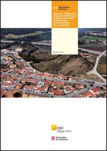
Present and future of geological risk management in urban planning
When
10.04.2025
from 12 noon to 2 p.m.
Where
Institut Cartogràfic i Geològic de Catalunya
Parc de Montjuïc
08038 Barcelona
Presentation of the "Guide for the Preparation of Geological Risk Identification Studies for Urban Planning".
Since 2006, the Urban Planning Law Regulations have established that urban planning must preserve for safe use areas subject to hazards that could affect the safety and well-being of people. Urban planning files must include the mandatory report from the Cartographic and Geological Institute of Catalonia (ICGC), which reviews urban planning actions from a geohazard perspective.
In the Guide for the Preparation of Geological Risk Identification Studies for Urban Planning, the ICGC establishes risk assessment criteria and proposes methods for determining the degree of risk, as well as the resulting recommendations. This guide, available in digital version since 2021, is now being updated and published in print.
The presentation event will be an opportunity to learn about the guide firsthand and discuss the treatment of geological risks in land use planning and development with experts from various fields of urban planning and geohazards.
PROGRAM:
| 12:00 - 12:10 | Welcome and introduction Antonio Magariños, Director of the Institut Cartogràfic i Geològic de Catalunya (ICGC) |
| 12:10 - 12:40 | Presentation of the Guide Pere Buxó, Head of the Engineering and Geological Risk Department, ICGC |
| 12:40 - 13:45 | Round Table: Present and future of geological risk management in urban planning and civil protection. How can the Guide contribute to risk management? Moderator: Joan Palau, Deputy Director of Geological and Geophysical Engineering, ICGC Speakers:
|
| 13:45 - 14:00 | Open speaking and closing session |
